Chapter 5 - Mexico and Central America
Genealogists' Guide to North America
Table of Contents
- Mexico The following is a list of the States of Mexico
- Aguascalientes
- Baja California
- Baja California Sur
- Campeche
- Chiapas
- Chihuahua
- Coahuila
- Federal District (Distrito Federal)
- Durango
- Estado de México (Mexico State)
- Guanajuato
- Guerrero
- Hidalgo
- Jalisco
- Michoacán
- Morelos
- Nayarit
- Nuevo León
- Oaxaca
- Puebla
- Querétaro
- Quintana Roo
- San Luis Potosí
- Sinaloa
- Sonora
- Tabasco
- Tamaulipas
- Tlaxcala
- Veracruz
- Yucatán
- Zacatecas
Mexico, officially the United Mexican States, is a country located in the southern portion of North America, covers a period of more than two millennia. First populated more than 13,000 years ago, the country produced complex indigenous civilizations before being conquered by the Spanish in the 16th century.
 Source: Eiris International School
Since the Spanish conquest, Mexico has fused its long-established native civilizations with European culture. Perhaps nothing better represents this hybrid background than Mexico's languages: the country is both the most populous Spanish-speaking country in the world and home to the largest number of Native American language speakers on the continent.
 Source: Time for Kids
From 1519, the Spaniards absorbed the native peoples into Spain's vast colonial empire. For three centuries Mexico was just another kingdom (the New Spain) of the Spanish Empire, during which time its indigenous population fell by more than half and was partially replaced by Spaniards and the now predominant Mestizos or mixture of Indigenous and Spanish populations. It was also then that the current Spanish-speaking, Catholic and Westernized Mexican culture was born. After a protracted struggle Mexico declared its independence from Spain in 1810. In 1846, the Mexican American War broke out, ending two years later with Mexico ceding almost half of its territory to the United States. Later in the 19th century, France invaded Mexico (1861) and set Maximilian I on the Mexican throne, which lasted until 1867. Little had been done for the nation's poor, and they revolted in the Mexican Revolution (1910–1929). Roaming armies killed a tenth of the nation's population, but the Revolution freed the peons from the system of large haciendas that had originated with the Spanish Conquest.
The first Europeans to arrive in what is modern day Mexico were the survivors of a Spanish shipwreck in 1511. On 8 February 1517 an expedition led by Francisco Hernández de Córdoba left the harbor of Santiago de Cuba to explore the shores of southern Mexico. This was the Europeans' first encounter with an advanced civilization in the Americas, with solidly built buildings and a complex social organization which they recognized as being comparable to those of the Old World.
Hernán Cortés led a new expedition to Mexico landing ashore at present day Veracruz on 22 April 1519, a date which marks the beginning of 300 years of Spanish hegemony over the region.
 Source: Georgiainfo.com
During the three centuries of colonial rule, less than 700,000 Spaniards, most of them men, settled in Mexico. The settlers intermarried with indigenous women, fathering the mixed race (mestizo) descendants who today constitute the majority of Mexico's population. The following map shows the extent of Mexican territory in 1821.
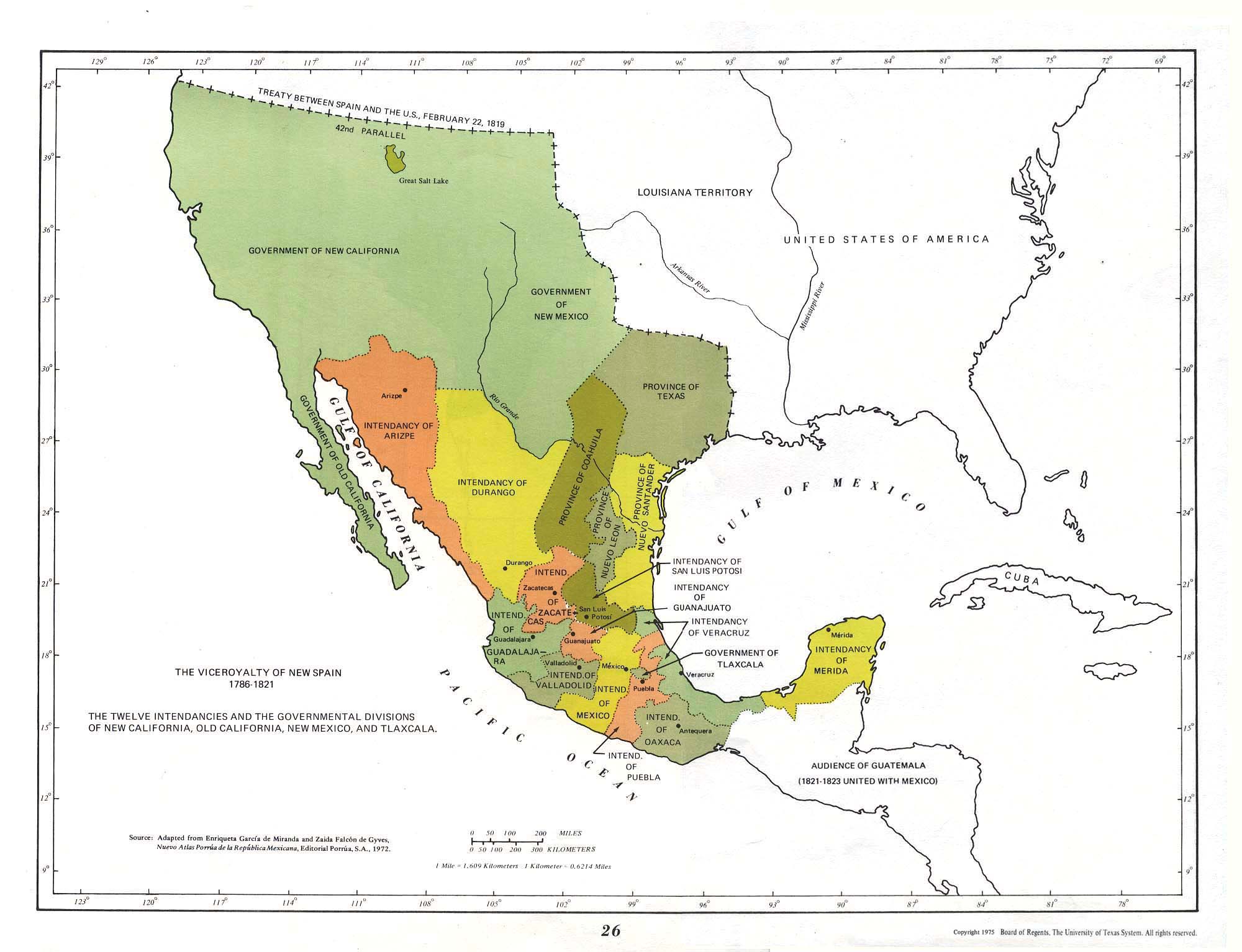
Source: http://mexicanhistory.org/colonial.htm
After 300 years and the loss of Mexican Territory in what is the present United States following the war with Mexico, present-day Mexico has 31 Federal States and a Federal District (like Washington, D.C.) The following map shows present day Mexico.
Source: Amazing-Mexico-Vacations.com
Mexico existed as Spanish territory before Independence and the formation of Mexico was a result of different Spanish Colonies in the New World either fighting or appealing to Spain for territorial boundaries. I have included a little information about each state in Mexico, but is recommended that the reader click on the various states (they are links) and read about that state in greater detail, especially in light of the various indigenous peoples who occupied the area and intermarried with the Spanish colonists.
The following is a list of the States of Mexico:
- #
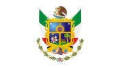
.png) Mexico State is located in the center of the country, consisting mostly of the eastern side of the Anahuác Mesa. Most of the state consists of the Toluca Valley, with the eastern panhandle mostly defined by the Chalco Valley. The state surrounds the Federal District of Mexico City on three sides.
Mexico State is located in the center of the country, consisting mostly of the eastern side of the Anahuác Mesa. Most of the state consists of the Toluca Valley, with the eastern panhandle mostly defined by the Chalco Valley. The state surrounds the Federal District of Mexico City on three sides.
.png)
- #
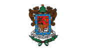
 Nuevo León was named after the New Kingdom of León, an administrative territory of the Viceroyalty of New Spain. In the 19th century, Nuevo León was in a growth spurt and the bargain land deals attracted immigrants of German, Slavic, French, Italian, Jewish and Anglo-American origin. The capital of Nuevo León is Monterrey, the third largest city in Mexico with over four million residents. Monterrey is a modern and affluent city, and Nuevo León has long been one of Mexico's most industrialized states.

- #
 Jalisco Many of the characteristic traits of Mexican culture, particularly outside Mexico, are originally from Jalisco, such as mariachi, ranchera music, tequila, jaripeo, etc. Economically, it is ranked third in the country, with industries centered in the Guadalajara metropolitan area, the second largest metropolitan area in Mexico. There is a significant foreign population, mostly retirees from the United States and Canada, living in the Lake Chapala and Puerto Vallarta areas.

- #
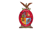
 Chihuahua is located in Northwestern Mexico. To the north and northeast, it has a long line with the U.S.–Mexico border adjacent to the U.S. states of New Mexico and Texas. Chihuahua is the largest state in Mexico, slightly larger than the United Kingdom. It is consequently known under the nickname El Estado Grande ("The Big State"). The state suffers the fallout of illicit trade and activities especially at the border.

- #
 Veracruz officially the Free and Sovereign State of Veracruz de Ignacio de la Llave is noted for its mixed ethnic and large indigenous populations. Its cuisine reflects the many cultural influences that have come through the state because of the importance of the port of Veracruz. Veracruz is considered to be where the "mestizo” or mixed Spanish/indigenous race began, which is a large part of Mexican cultural identity. During Colonial Mexico Veracruz was one of the main ports of entry for African slaves that replaced the indigenous slaves of Mexico. One of the reasons[citation needed] for replacing the indigenous Mexicans was that millions of indigenous slaves died from smallpox brought by the Spanish. The gastronomy of the state is unique in Mexico and mixed Spanish, indigenous, and other influences. From the pre-Hispanic period, the cuisine of the state was unique. The staple triumvirate of corn, beans, and squash was supplemented by tropical fruits, vanilla beans, and an herb called acuyo or hoja santa. Another important native contribution is seafood. After the conquest and during the colonial period, many other spices and ingredients were brought and have had a greater influence in the cooking here than in other parts of the country. Caribbean imports such as sugar cane and pineapple were adapted as well as the peanut, brought from Africa by the Portuguese via Brazil. Other African ingredients include plantains, yucca, and sweet potatoes.

- #
 Puebla is one of the most industrialized in the country, but since most of its development is concentrated in Puebla and other cities, many of its rural areas are very poor, forcing many to migrate away to places such as Mexico City and the United States. Culturally, the state is home to the China Poblana, mole poblano, active literary and arts scenes and festivals such as Cinco de Mayo, Ritual of Quetzalcoatl, Day of the Dead celebrations and Carnival.
- #
 Baja California is both the northernmost and westernmost state of Mexico, but before becoming a state in 1953, the area was known as the North Territory of Baja California. It comprises the northern half of the Baja California peninsula, north of the 28th parallel. The state is bordered on the west by the Pacific Ocean, on the east by Sonora, the U.S. State of Arizona, and the Gulf of California (also known as the Sea of Cortez), and on the south by Baja California Sur. Its northern limit is the U.S. state of California. Europeans reached the present state of Baja California in 1539. Historically Baja California was the Spanish colony of California, divided in to Alta (North) and Baja (South). The United States annexed Alta California in 1848.

- #
 California Sur or South Lower California, is the least populated state in Mexico. Tourism is the main industry. It is bordered to the north by the state of Baja California, to the west by the Pacific Ocean, and to the east by the Gulf of California, also known as the "Sea of Cortés." Also, the state has maritime borders with Sonora and Sinaloa to the east across the Gulf of California.

- #
 Guanajuato is located between the arid north of the country and the lusher south, and it is geographically part of the Trans-Mexican Volcanic Belt, the Mexican Plateau and the Sierra Madre Oriental. It was initially settled by the Spanish in the 1520s due to mineral deposits found around the now capital city of Guanajuato, but areas such as the Bajío region also became important for agriculture and livestock. Mining and agriculture have been the traditional mainstays of the state's economy. The state is better known as the producer of a number of food products such as cajeta, bread, candy, and ice cream.

- #
 Coahuila The Spanish explored the north of Mexico some decades after their victory in the capital of the Aztecs. Such exploration was delayed because the northern climate was harsher and there was no gold. The first Spanish settlement in the region was in 1577. Saltillo was settled in 1586 to form part of the province of New Spain, Nueva Vizcaya of the vice-royalty. Later it became one of the first provinces of Nueva Extremadura to be explored by Europeans. "Coahuila and Texas" was one of the constituent states of the newly independent United Mexican States under its 1824 Constitution, and included Texas, Coahuila, and Nuevo León. Later in the same year Nuevo León was detached, but Texas remained a part of the state until 1835, when it seceded to form the Republic of Texas. In 1840 Coahuila briefly became a member of the short lived Republic of the Rio Grande. On February 19, 1856, Santiago Vidaurri annexed Coahuila to his state, Nuevo León, but it regained its separate status in 1868.

- #
 Tamaulipas has a 370 km (142.9 mi) stretch of the U.S.-Mexico border along the state of Texas. Apparently, some Tamauli immigrated to Coastal Plain of the present state of Georgia, when the region was overrun by Chichimec barbarians. They lent their name to the Altamaha River, plus many Totonac and Itza Maya words to the Creek Indian language. Tamaulipas was originally populated by the Olmec people and later by Chichimec and Huastec tribes. Between 1445 and 1466, Mexica (or Aztec) armies commanded by Moctezuma I Ilhuicamina conquered much of the territory and transformed it into a tributary region for the Mexica empire. Although Hernán Cortés conquered the Aztecs rather quickly, it took a gradual process for Spain to subjugate the inhabitants of Tamaulipas in the 16th and 17th centuries. The first permanent Spanish settlement in the area was Tampico in 1554. Further settlement was done by Franciscan missionaries, widespread cattle and sheep ranching by the Spanish bolstered the area’s economy while forcing native populations from their original lands. Repeated indigenous rebellions kept the area unstable and weakened colonial interest in the region. What is now Tamaulipas was first incorporated as a separate province of New Spain in 1746 with the name Nuevo Santander. In the middle 17th century various Apache bands from the southern Plains, after acquiring horses from Spaniards in New Mexico, moved southeastward into the Edwards Plateau, displacing the native hunting and gathering groups. After 1750, when most Apache groups of the central Texas highlands were displaced by Comanche and moved into the coastal plain of southern Texas. Many Indian groups of missions in southern Texas and northeastern Mexico had recently been displaced from their territory through the southward push by the Lipan Apaches and were still hostile toward Apaches, linking arms with the local Spanish authorities against their common foe. By 1790 Spaniards turned their attention from the aboriginal groups and focused on containing the Apache invaders. In northeastern Coahuila and adjacent Texas, Spanish and Apache displacements created an unusual ethnic mix. Here the local Indians mixed with displaced groups from Coahuila and Chihuahua and Texas. Some groups, to escape the pressure, combined and migrated north into the Central Texas highlands.
- #
 Sonora shares the U.S.–Mexico border with the states of Arizona and New Mexico, and on the west has a significant share of the coastline of the Gulf of California. It has been economically important for its agriculture, livestock (especially beef) and mining since the colonial period, and for its status as a border state since the Mexican–American War. After the Gadsden Purchase, Sonora lost more than a quarter of its territory. From the 20th century to the present, industry, tourism and agribusiness have dominated the economy, attracting migration from other parts of Mexico.
- #
 Michoacán formally Michoacán de Ocampo and means "place of the fishermen" referring to those who fish on Lake Pátzcuaro. The economy is based on agriculture, fishing, mining and some industry. The major tourism draw for the state is the Lake Pátzcuaro–Tzintzuntzan–Quiroga area, which was the center of the Tarascan Empire.
- #
 San Luis Potosí and its capital are both named after Louis IX of France (also known in Mexico as San Luis Rey de Francia, Saint Louis, King of France), its patron saint. The Potosí was added in reference to the fabulously rich mines of Potosí, Bolivia, believed to have enough gold to build a bridge between Bolivia and Spain. Thereafter, upon the development of Cerro de San Pedro near the capital city, they found such gold wealth that they compared it to that of Potosi and thus they named it as such. The wealth of these mines is thought to be comparable to that of the local mines at Cerro de San Pedro.

- #
 Sinaloa Culturally is known for a style of music known as banda, and corrido is also popular. It is the only place in the continent where the ancient ball game of Mesoamerica is still played, in a handful of small, rural communities not far from Mazatlán. The ritual ball game was central in the society, religion and cosmology of all the great Mesoamerican cultures including the Mixtecs, Aztecs, and Maya. The Sinaloa version of the ball game is called ulama, and is very similar to the original.There are efforts to avoid the extinction of this 3500-year old unique tradition by supporting the communities and children who still play it.
- #
 Querétaro is one of the smallest in Mexico, but it is also one of the most heterogeneous geographically,[9][10] with ecosystems varying from deserts to tropical rainforest, especially in the Sierra Gorda, which is filled with microecosystems Living standards are higher than average for Mexico in and around the city of Querétaro, but diminish significantly in the rural areas. One important factor in the population growth has been migration into the state from other parts of Mexico due to the state’s industry, low crime rate and other factors. One recent phenomenon has been the influx of families from northern border states migrating south to escape drug-related violence.
- #
 Chiapas is home to the ancient Mayan ruins of Palenque, Yaxchilán, Bonampak, and Chinkultic. It is also home to one of the largest indigenous populations in the country with twelve federally recognized ethnicities. Much of the state’s history is centered on the subjugation of these peoples with occasional rebellions. In the early 20th century and into the Mexican Revolution, the production of coffee was particularly important but labor intensive. This would lead to a practice called "enganche" (hook) where recruiter would lure workers with advanced pay and other incentives such as alcohol and then trap them with debts for travel and other items to be worked off. This practice would lead to a kind of indentured servitude and uprisings in areas of the state, although they never led to large rebel armies as in other parts of Mexico.

- #
 Guerrero was named after Vicente Guerrero, one of the most prominent leaders in the Mexican War of Independence and the second President of Mexico.[9] It is the only Mexican state named after a president. The modern entity did not exist until 1849, when it was carved out of territories from the states of Mexico, Puebla and Michoacán. Tourism is the single most important economic factor of the state and Acapulco’s tourism is important to the nation’s economy as a whole. However, other sources of employment are scarce in the state, which has caused its ranking as number one in the emigration of workers to the United States.

- #
 Quintana Roo is located in Southeastern Mexico, on the eastern part of the Yucatán Peninsula. It is bordered by the states of Yucatán to the northwest and Campeche to the west. To the north, Quintana Roo borders the Gulf of Mexico and to the south, Belize. It also claims territory which gives it a small border with Guatemala in the southwest of the state, although this disputed area is also claimed by Campeche. Quintana Roo is home of the world famous city of Cancún, the islands of Cozumel and Isla Mujeres, the towns of Bacalar, Playa del Carmen and Akumal, as well as the ancient Maya ruins of Chacchoben, Coba, Kohunlich, Muyil, Tulum, Xel-Há, and Xcaret. The Sian Ka'an Biosphere Reserve is also in the state. Since 1997 there is a boundary dispute with the states of Yucatán and Campeche over an area of approximately 3,900 sq miles.

- #
 Oaxaca is best known for its indigenous peoples and cultures. The most numerous and best known are the Zapotecs and the Mixtecs, but there are sixteen that are officially recognized. These cultures have survived better than most others in Mexico due to the state’s rugged and isolating terrain. Most live in the Central Valleys region, which is also an important area for tourism, attracting people for its archeological sites such as Monte Albán, native culture and crafts. Another important tourist area is the coast, which has the major resort of Huatulco. Oaxaca is also one of the most biologically diverse states in Mexico, ranking in the top three, along with Chiapas and Veracruz, for numbers of reptiles, amphibians, mammals and plants. During the Mexican War of Independence the government of this area remained loyal to the Spanish Crown. When representatives of Miguel Hidalgo y Costilla came to meet with them, they were hanged and their heads left out in view. After 1812, insurgents began to have some success in the state, but the capital remained in royalist hands until the end of the war. The state was initially a department after the war ended in 1821, but after the fall of emperor Agustín de Iturbide, it became a state in 1824.

- #
 Yucatán Before the arrival of Spaniards to the Yucatán Peninsula, the name of this region was el Mayab.[12] In Mayan language, "ma' ya'ab" is translated as "a few". It was a very important region for the Mayan civilization, which reached the peak of its development on this place, where they founded the cities of Chichen Itza, Izamal, Motul, Mayapan, Ek' Balam and Ichcaanzihóo (also called T'Hó), now Mérida. After the Spanish conquest, Yucatán Peninsula was a single administrative and political entity, the Captaincy General of Yucatán. Following independence and the breakup of the Mexican Empire in 1823, the first Republic of Yucatán was proclaimed which then was voluntarily annexed to the Federal Republic of United Mexican States on December 21, 1823. Later on March 16, 1841, as result of cultural and political conflicts around the federal pact, Yucatán declared independence from Mexico to form a second Republic of Yucatán, but eventually on July 14, 1848, Yucatán was definitely rejoined to Mexico. In 1858, in the middle of the caste war, the state of Yucatan was divided for the first time, establishing Campeche as separate state (officially in 1863). During the Porfiriato, in 1902, the state of Yucatan was divided again to form the Federal territory that later became the present state of Quintana Roo. Today, Yucatán is the safest state in Mexico.

- #
 Morelos is the second-smallest state in the nation, just after Tlaxcala. It was part of the very large province then State of Mexico until 1869, when Benito Juárez decreed that its territory would be separated and named in honor of José María Morelos y Pavón, who defended the city of Cuautla from royalist forces during the Mexican War of Independence. Most of the state enjoys a warm climate year-round, which is good for the raising of sugar cane and other crops. Morelos has attracted visitors from the Valley of Mexico since Aztec times. Today, many people from Mexico City spend weekends in the state or own second homes there, especially in the Cuernavaca area. The state is also known for the Chinelos, a type of costumed dancer that appears at festivals, especially Carnival.
- #
 Durango along with the states of Chihuahua, Sonora and Sinaloa, formed the historical and geographical unity of Northern Mexico, for what was the majority of the last millennium; it wasn't until the territories were reorganized after the independence struggle that they emerged as independent entities. Once the province of New Spain was established in the rest of the country, new explorers ventured out to conquer Northern Mexico, establishing the province of Nueva Vizcaya, in honor of the Spanish province of the same name. In 1552 Spanish Captain, Ginés Vázquez del Mercado, discovered one of the world's richest iron-ore deposits in Durango. Durango is known nationally and even internationally for two reasons: one being that it is "the land of the scorpions" due to the many species of scorpions in the state, especially in the colonial areas, and second as "the land of cinema." Durango has among its credits over 120 film productions, both domestic and foreign, and as a result, during the decades of the 1950s, 60s, 70s and 80s, had earned that title. Durango has established itself as one of the favorite places of film producers and directors due to its picturesque views and scenic beauty.

- #
 Hidalgo contains a number of ecotourism, cultural and archeological attractions including the Huasteca area, the ruins of Tula, natural hot water springs, old haciendas and mountain ranges.

- #
 Aguascalientes originated around the times of colonial Spanish influence. It is located in the middle of the country and is now beginning to make a name for itself as an industrial power within Mexico. The state was once a major silver miner and a major source of railroad transportation, the latter due to its strategic location, midway between the three most populous areas, namely Mexico City, Guadalajara, and Monterrey.In the rural area, Aguascalientes was once the largest national producer of grapes and wines. This tradition ceased gradually due to the Spanish Royalty's wishes that grape and wine production be limited to the mother country. Thanks to the influx of immigrants into Mexico, the wineries and vineyards remain and flourish. Guavas are also produced in the state. Although this state is not often billed as a tourist center, international visitors, as well as citizens from all over Mexico, are attracted to the San Marcos Fair, which is considered the national fair of Mexico and contributes much to Mexico's economy.
- #
 Tabasco Most of Tabasco is covered in rainforest as, unlike most other areas of Mexico, it has plentiful rainfall year round. For this reason, it is also covered in small lakes, wetlands and rivers. The state is subject to major flooding events, with the last occurring in 2007, which affected eighty percent of the state. The state is also home to La Venta, the major site of the Olmec civilization, considered to be the origin of later Mesoamerican cultures. Even though it produces significant quantities of petroleum and natural gas, poverty is still a concern. The state is also the origin of the cocoa bean, from which chocolate is made.

- #
 Campeche The state capital, also called Campeche, was declared a World Heritage Site in 1997. The formation of the state began with the city, which was founded in 1540 as the Spanish began the conquest of the Yucatán Peninsula. During the colonial period, the city was a rich and important port, but declined after Mexico’s Independence. Campeche was part of the province of Yucatán but split off in the mid-19th century, mostly due to political friction with city of Mérida. Today, much of the state’s economic comeback is due to the finding of petroleum offshore in the 1970s, which has made the coastal cities of Campeche and Ciudad del Carmen important economic centers. The state has important Mayan and colonial sites but they are not as well known or visited as others in the Yucatán.

- #
 Zacatecas is best known for its rich deposits of silver and other minerals, its colonial architecture and its importance during the Mexican revolution. Its main economic activities are mining, agriculture and tourism. On September 8, 1546, with the discovery of its mines, the present city of Zacatecas was founded. It was originally baptized "Minas de los Zacatecas" or "Mines of the Zacatecas". Its rich mineral wealth gave the Spanish Crown a great amount of income (the silver mines in Zacatecas and Potosi, Bolivia, were the Spanish crown's largest sources of income during colonialism), which gave the city of Zacatecas the title of "Ciudad de Nuestra Señora de los Zacatecas".
- #
 Nayarit contains hundreds of miles of rain forest in the sierra. Its wildlife includes jaguars, mountain lions, wild bears, deer, caymans, armadillos, small wild cats and many more species. Unfortunately most of the rain forest has been exploited, especially around the region of Santa Maria Del Oro. The conservation and protection of the rain forest and wildlife of Nayarit is an issue of crucial importance. Besides the mainland, the islands Marias, Isabel, Tres Marietas and Farallón La Peña in the Pacific Ocean are part of its territory.

- #
 Colima is a small state located in the Western Mexico region on Mexico’s central Pacific coast. Despite being the fourth smallest entity in Mexico with the lowest numerical population, the state has one of Mexico’s highest standards of living and lowest unemployment. The majority of the population is non-indigenous. Colima’s most important tourism destination is the beaches of Manzanillo, which is popular among those in western Mexico as well as many sports fishermen. Historically, the port was the point of departure for various maritime expeditions and received the annual Manila Galleon from the Philippines.

- #
 Tlaxcala Most of the state’s economy is based on agriculture, light industry and tourism. The tourist industry is rooted in Tlaxcala’s long history with major attractions being archeological sites such as Cacaxtla and colonial constructions in and around Tlaxcala city. Most livestock raised in the state is beef cattle and dairy cows along with the renowned fighting bulls.
- #
 Federal District Mexico City (Spanish: Ciudad de México, also known as México D.F., is the Federal District (Distrito Federal), capital of Mexico and seat of the federal powers of the Mexican Union. It is a federal entity within Mexico which is not part of any one of the 31 Mexican states but belongs to the federation as a whole. Mexico City is the country's largest city as well as its most important political, cultural, educational and financial center. As an "alpha" global city Mexico City is one of the most important financial and cultural centers in North America. It is located in the Valley of Mexico (Valle de México), a large valley in the high plateaus at the center of Mexico, at an altitude of 7,350 ft. The city consists of sixteen boroughs. In 1997, citizens of the Federal District were granted national voting rights. The city currently known as Mexico City was founded by the Mexica people, later known as the Aztecs, in 1325. The old Mexica city is now referred to as Tenochtitlan. The Mexica were one of the last of the Nahuatl-speaking peoples who migrated to this part of the Valley of Mexico after the fall of the Toltec Empire. Their presence was resisted by the peoples who were already in the valley, but the Mexica were able to establish a city on a small island on the western side of Lake Texcoco. When the Spaniards arrived, the Aztec Empire reached much of Mesoamerica, touching both the Gulf of Mexico and the Pacific Ocean. Scholars estimate that between 200,000 and 250,000 people lived in Tenochtitlan in 1500, more than four times the population of London at that time. Tenochtitlán was renamed "Mexico", its alternative form name, only because the Spanish found this easier to say. Originally, much of the valley laid beneath the waters of Lake Texcoco, a system of interconnected saline and freshwater lakes. The Aztecs built dikes to separate the fresh water used to raise crops in chinampas and to prevent recurrent floods. These dikes were destroyed during the siege of Tenochtitlan, and during colonial times the Spanish regularly drained the lake to prevent floods. Only a small section of the original lake remains, located outside the Federal District, in the municipality of Atenco, State of Mexico.

# Belize formerly British Honduras, is a country located on the north eastern coast of Central America. It is the only country in the area where English is the official language, although Kriol and Spanish are more commonly spoken. Belize is bordered to the north by Mexico, to the south and west by Guatemala and to the east by the Caribbean Sea. English and Scottish settlers and pirates known as the Baymen entered the area in the 16th and 17th century respectively and established a logwood trade colony in what would become the Belize District. Baymen first settled on the coast of Belize in 1638, seeking a sheltered region from which they could attack Spanish ships. The settlers turned to cutting logwood during the 18th century. The wood yielded a fixing agent for clothing dyes that was vital to the European woolen industry. The Spanish granted the British settlers the right to occupy the area and cut logwood in exchange for an end to piracy.
# Costa Rica meaning "rich coast" in Spanish), officially the Republic of Costa Rica (Spanish: República de Costa Rica, is a country in Central America, bordered by Nicaragua to the north, Panama to the southeast, the Pacific Ocean to the west, and the Caribbean Sea to the east. During most of the colonial period, Costa Rica was the southernmost province of the Captaincy General of Guatemala, which was nominally part of the Viceroyalty of New Spain (i.e., Mexico), but which in practice operated as a largely autonomous entity within the Spanish Empire. Costa Rica's distance from the capital in Guatemala, its legal prohibition under Spanish law to trade with its southern neighbors in Panama, then part of the Viceroyalty of New Granada (i.e., Colombia), and the lack of resources, such as gold and silver, made Costa Rica into a poor, isolated, and sparsely inhabited region within the Spanish Empire.
# El Salvador is the smallest and the most densely populated country in Central America. In 1520 the indigenous population of the territory had been reduced by 80% due to the smallpox epidemic that affected the Mesoamerican area. The Spanish Admiral Andrés Niño led an expedition to Central America and disembarked on Meanguera island, which he named Petronila, in the Gulf of Fonseca, on May 31, 1522. Thereafter he discovered Jiquilisco Bay on the mouth of Lempa River. This was the first known visit by Spaniards to what is now Salvadoran territory. Permanent Spanish settlement occurred in 1527. After arriving in what was named the New World, the Spanish started several expeditions to Guatemala, beginning in 1519.
# Guatemala, officially the Republic of Guatemala (Spanish: República de Guatemala is a country in Central America bordered by Mexico to the north and west, the Pacific Ocean to the southwest, Belize to the northeast, the Caribbean to the east, and Honduras and El Salvador to the southeast. Guatemala became independent from Spain in 1821. After it became an independent country in its own right, it was ruled by a series of dictators, It is now a representative democracy. During the colonial period, Guatemala was an Audiencia and a Captaincy General of Spain, and a part of New Spain (Mexico). The first capital was named Tecpan Guatemala, founded on July 25, 1524 with the name of Villa de Santiago de Guatemala and was located near Iximché, the Kaqchikel capital city.
# Honduras is a republic in Central America. It was at times referred to as Spanish Honduras to differentiate it from British Honduras, which became the modern-day state of Belize. Much of the country was conquered by Spain which introduced its now predominant language and many of its customs in the sixteenth century. It became independent in 1821 and was for a time under the Mexican Empire. After 1838 it was an independent republic and held regular elections. It has been a republic since the end of Spanish rule. Honduras was first organized as a province of the "Kingdom of Guatemala" .
# Nicaragua, officially the Republic of Nicaragua (Spanish: República de Nicaragua), is the largest country in the Central American isthmus, bordering Honduras to the north and Costa Rica to the south. The Spanish Empire conquered the region in the 16th century. Nicaragua achieved its independence from Spain in 1821. Since its independence, Nicaragua has undergone periods of political unrest, dictatorship, and fiscal crisis. It was not until 1524 that the first Spanish permanent settlements were founded. In 1536, the Viceroyalty of New Spain was established. By 1570, the southern part of New Spain was designated the Captaincy General of Guatemala. The area of Nicaragua was divided into administrative "parties" with León as the capital. In 1610, the Momotombo volcano erupted, destroying the capital. It was rebuilt northwest of what is now known as the Ruins of Old León. During the American Revolutionary War, Central America was subject to conflict between Britain and Spain, as Britain sought to expand its influence beyond coastal logging and fishing communities in present-day Belize, Honduras and Nicaragua. The Captaincy General of Guatemala was dissolved in September 1821 with the Declaration of Independence of the Mexican Empire, and Nicaragua became part of the First Mexican Empire. After the monarchy of the First Mexican Empire was overthrown in 1823, Nicaragua joined the newly formed United Provinces of Central America, which was later renamed as the Federal Republic of Central America. Nicaragua finally became an independent republic in 1838.
# Panama, Spanish: Panamá, officially the Republic of Panama (Spanish: República de Panamá), is the southernmost country of Central America. Situated on the isthmus connecting North and South America, it is bordered by Costa Rica to the west, Colombia to the southeast, the Caribbean to the north and the Pacific Ocean to the south. The capital is Panama City. Explored and settled by the Spanish in the 16th century, Panama broke with Spain in 1821 and joined a union of Nueva Granada, Ecuador, and Venezuela, named the Republic of Gran Colombia. When Gran Colombia dissolved in 1831, Panama and Nueva Granada remained joined. Nueva Granada later became the Republic of Colombia. With the backing of the United States, Panama seceded from Colombia in 1903, allowing the Panama Canal to be built by the U.S. Army Corps of Engineers between 1904 and 1914. In 1977, an agreement was signed for the complete transfer of the Canal from the United States to Panama by the end of the 20th century.
- Related Topics